Measure how the shoreline is changing
Coastlines and wetlands shift season to season — but without consistent measurement, erosion and vegetation loss are hard to prove and harder to plan around. AeroTech UAV captures the elevation, vegetation, and shoreline data that quantify change over time and support restoration and permitting decisions.
Map the submerged & the shoreline
From the air, AeroSpectra maps seagrass and submerged aquatic vegetation (SAV), flags prop-scar damage cutting through the beds, and measures where the shoreline is gaining or losing ground — the baseline every restoration and permit needs.
Real project: Apalachicola Bay drone oyster seeding
Under FDACS Contract 30646, AquaTech — with ARCA and the FSU Coastal & Marine Lab — used heavy-lift drones to deploy roughly 36 million oyster seed across one-acre restoration grids in Apalachicola Bay (Nov 2023–June 2024), helping rebuild a fishery that collapsed in 2013. Seed was dispersed at low, slack tide from Hylio AG-210 and AG-272 drones, with FSUCML monitoring settlement and survival.
The breakthrough: an off-the-shelf heavy-lift agri-drone — used without modification — paired with a proprietary growth-enriching seed mix to spread oyster seed evenly across each acre at centimeter-accurate RTK precision. Agriculture technology, adapted to aquaculture. The approach was presented at the 38th Annual Environmental Permitting Summer School (Marco Island, 2024).
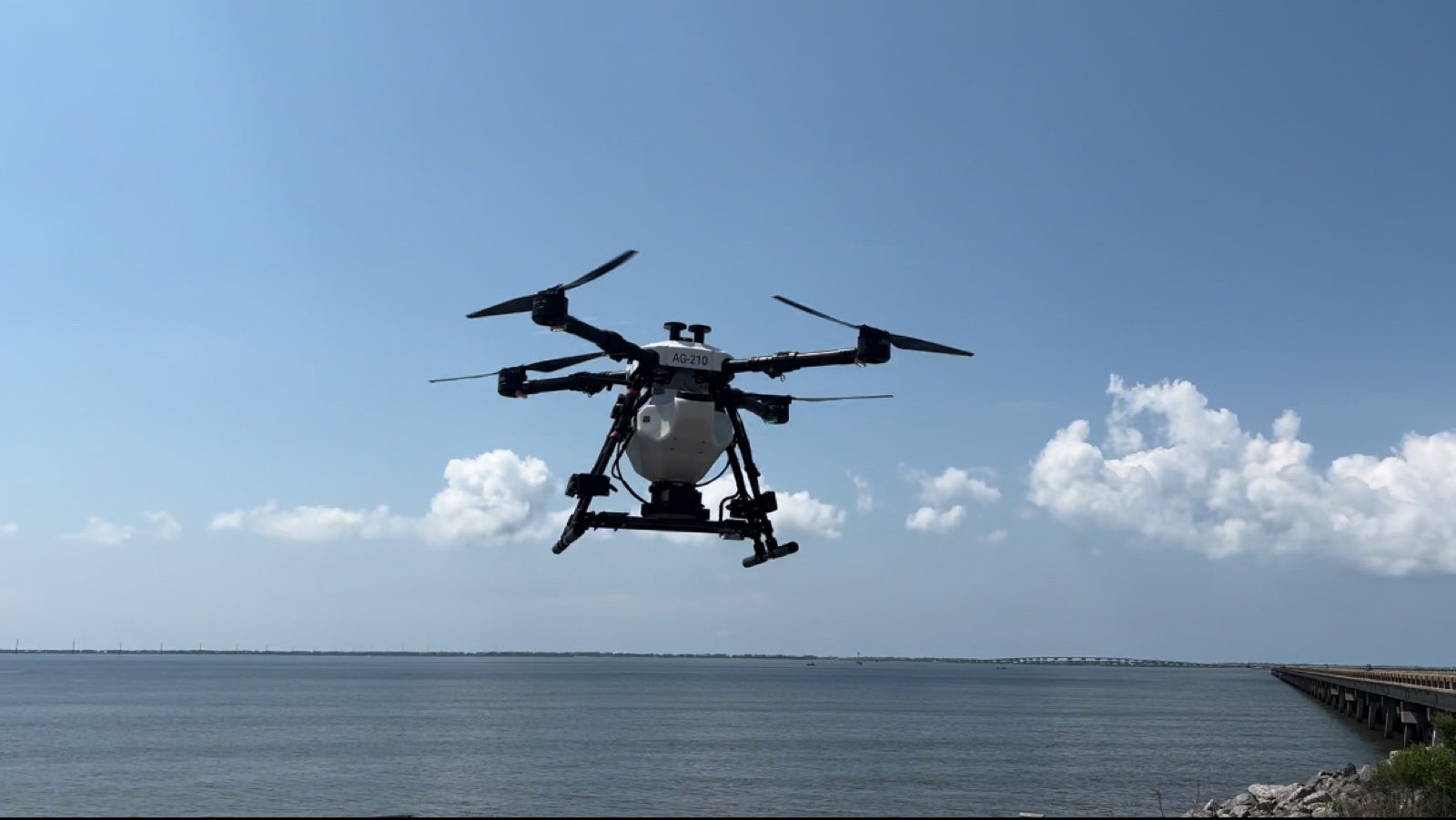
A Hylio AG-210 deploying oyster seed over Apalachicola Bay.
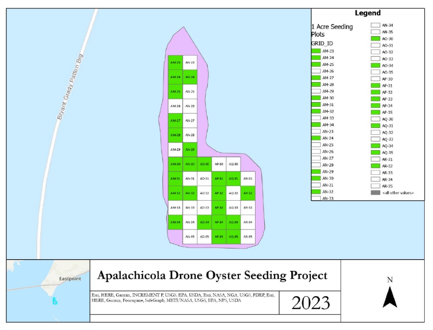
Actual AquaTech deliverable — Apalachicola Drone Oyster Seeding Project, FDACS Contract 30646. Green = one-acre grids seeded by heavy-lift drone, 2023–2024.
Watch: a Hylio heavy-lift drone seeding oysters over Apalachicola Bay.
Why it matters
In the news: protecting Florida's waters
Healthy estuaries depend on water quality. See how Florida's marine-science community is deploying new technology to fight the harmful red-tide blooms that threaten our coasts.
WINK News — Mote Marine Laboratory unveils technology to fight harmful red-tide blooms.
Fly it, map it, monitor it
Fly
Low-tide, clear-water flights capture seagrass beds, scars, and shoreline in high-resolution RGB + multispectral.
Map SAV
AeroSpectra delineates seagrass/SAV extent and density and flags prop-scar damage cutting through the beds.
Measure change
Repeat flights quantify shoreline advance/retreat and SAV gain or loss against your baseline.
Restore & document
Site plans for living shorelines, reef and seagrass restoration — plus the monitoring record to prove it worked.
What we capture & detect
High-resolution RGB and multispectral imagery map vegetation health, while photogrammetry produces a digital surface model (DSM) that captures elevation and terrain. Flown on a repeating schedule, these layers reveal how shorelines, sediment, and vegetation are moving — change that's invisible in any single visit.
Shoreline erosion
Track the advance and retreat of the water boundary and quantify land loss between flights.
Vegetation health
Assess mangrove, seagrass, and aquatic vegetation vigor with multispectral indices.
Elevation & volume
Digital surface models support volumetric estimates for sediment, fill, and restoration work.
What you get back
Georeferenced deliverables that quantify change and support planning, permitting, and restoration.
- Change-detection maps comparing shoreline and vegetation across monitoring periods.
- Digital surface models for elevation analysis and volumetric estimates.
- Vegetation health overlays for mangrove and aquatic communities.
- GeoTIFF, KML & shapefiles ready for your GIS and permit documentation.
Why it matters
Coastal change has real consequences — for property, habitat, and compliance. Repeatable aerial measurement gives you defensible numbers on erosion rates and vegetation trends, reaches wetland terrain that's unsafe or impossible to survey on foot, and builds the time-series record that supports restoration planning and regulatory review. For Florida's dynamic coastlines, that consistent baseline is the foundation every decision rests on.
Ready to map your coastline?
Tell us about your site and monitoring goals. We'll outline a flight plan and a tailored quote within 1–2 business days.
Request Your Free Consultation