AeroTech UAV doesn't just map your land — we treat it. Our drones capture the data and pinpoint the problem, then spray, spread, and deploy the fix with centimeter precision. We don't just show you what's wrong — we fly the solution.
Mapping finds the problem; our heavy-lift drones solve it. AeroTech UAV runs the full cycle in-house — from the survey flight to the spray, spread, and seed that puts the treatment exactly where the data says it's needed.
Multispectral & thermal mapping plus AI pinpoint the problem — crop stress, weeds, invasives, panel faults — by exact GPS location.
A variable-rate zone map tells the drone exactly where to treat — and how much. No blanket spraying the whole site.
Heavy-lift drones spray (liquid) and spread (dry granular) the treatment right on the zones — day or night, with centimeter accuracy.
From invasive control to oyster seeding and seagrass restoration, we put the solution into the ground and water — not just a report.
Your project is flown by a certified pilot operating under the full set of FAA authorizations — including the exemptions required for heavy-lift spray drones.
Certified Remote Pilot
Authorized to operate UAS over 55 lbs
Agricultural Aircraft Operator — aerial application
Beyond Visual Line of Sight operations
From row crops to coastlines, we capture, analyze, and deliver the insights you need to act with confidence.
Crop health monitoring, weed and stress detection, and variable-rate treatment maps that cut input costs and boost yield.
Learn more →Turf health, early disease detection, and irrigation optimization that keep fairways and greens in championship condition.
Learn more →Thermal panel inspection, fault detection, and vegetation encroachment monitoring to maximize energy output.
Learn more →Invasive species mapping, habitat assessment, and mitigation-bank monitoring for compliance and conservation.
Learn more →Shoreline erosion tracking, mangrove and aquatic vegetation health, and change detection over time.
Learn more →Research-grade multispectral capture, multi-layer analysis, and flexible reporting tailored to your goals.
Learn more →A straightforward process that delivers professional results without the complexity.
We design the flight and collect high-resolution RGB, multispectral, and thermal imagery over your site.
Imagery is stitched and run through our AeroSpectra analysis engine and AI detection models.
We identify stress, disease, weeds, or invasive species and produce clear, zoned treatment maps.
You receive reports, shapefiles, and ready-to-fly spray missions — or we execute the treatment for you.
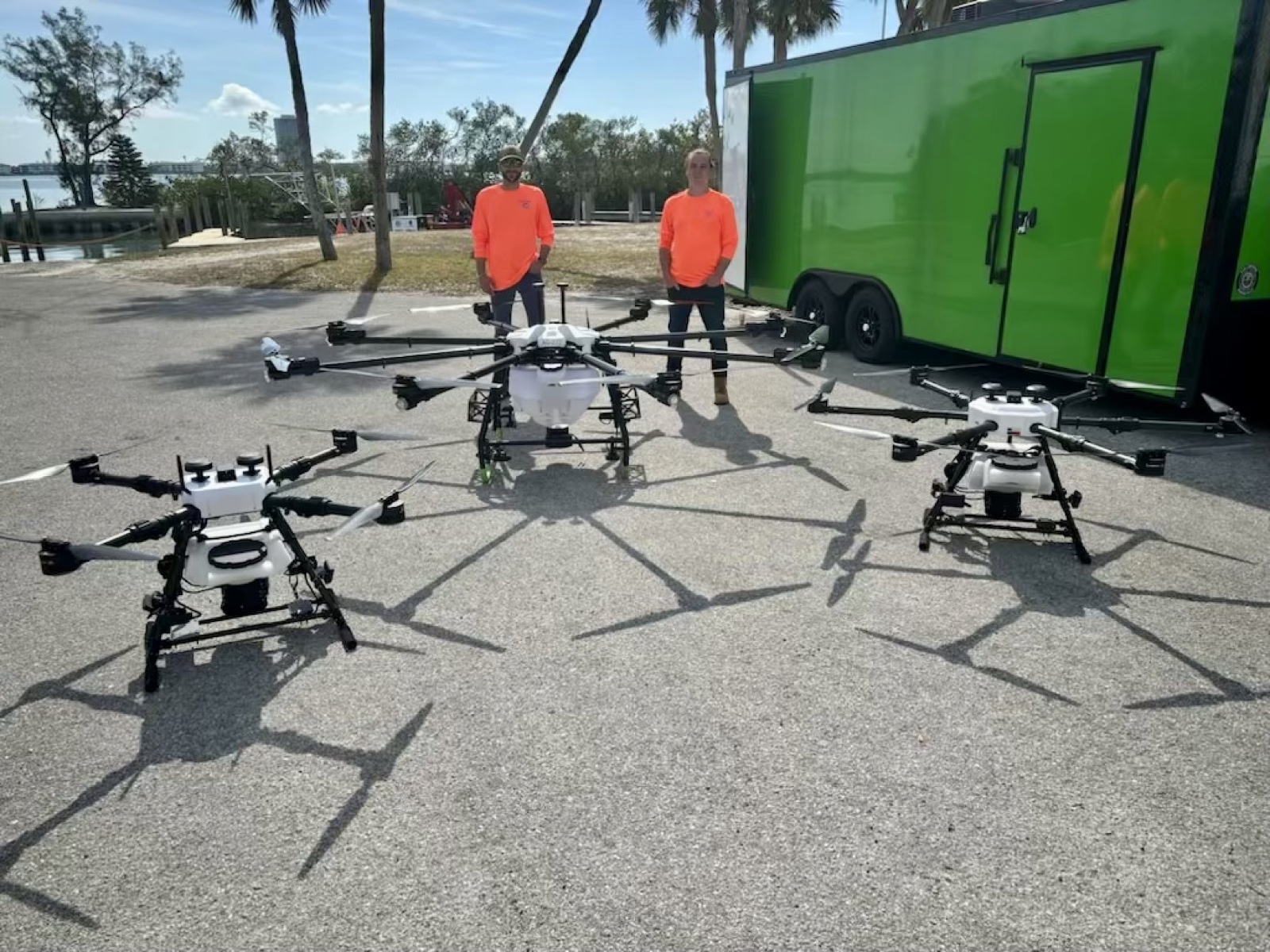
We fly purpose-built Hylio aircraft — American-made, NDAA-compliant, and capable of both liquid and dry application. From portable mapping to heavy-lift spraying.
Ultra-portable mapping UAS with the GS1-x camera setup (RGB + thermal gimbal) and a multispectral payload (MicaSense RedEdge-P Dual) for crop-health data.
Agile drone for targeted treatments, smaller parcels, and tight, detailed application zones.
Balanced payload and coverage for efficient treatment of mid-size fields, fairways, and managed sites.
Our largest-capacity platform for high-throughput application across large acreage.
We don't just fly drones — we run a purpose-built multispectral analysis platform that transforms raw imagery into decisions you can act on the same day.
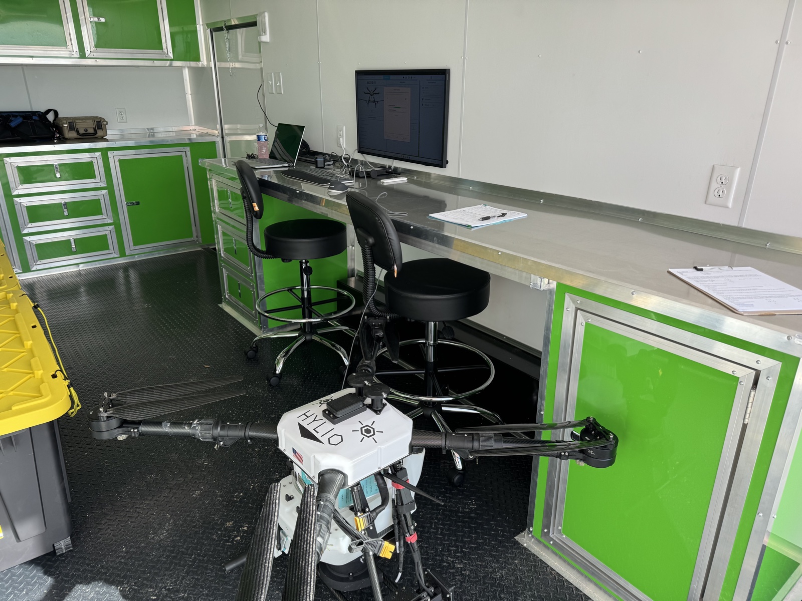
Our mobile command center deploys on-site — AgroSol mission control, RTK base-station, and live analysis run right at the project.
A look at the software behind every project — built in-house for fast, professional multispectral analysis. Now live — explore the platform yourself.
Toggle RGB, VARI, NDVI, NDRE & thermal index layers and sample real index values anywhere on the map.
Species detection with confidence scoring, plus field ground-truth capture to train on Florida-specific targets.
One-click PDF reports per analysis module, with GeoJSON & CSV exports ready for ArcGIS and QGIS.
We pair licensed, professional drone operations with serious analytics — so you get more than pretty pictures. You get answers.
AeroTech UAV is a Florida-based drone company that maps your land — and then does the work. Precision aerial mapping and multispectral analysis, paired with heavy-lift drone application: spraying, spreading, seeding, and restoration. We help growers, land managers, golf courses, solar operators, and environmental teams find the problem and fly the fix.
Our mission is simple: bring high-end aerial intelligence down to earth — accurate, affordable, and genuinely useful for the people working the land every day.
In partnership with AquaTech Eco Consultants — a restoration firm with 25+ years of coastal mitigation, restoration, and research across Florida, the Chesapeake Bay, the Caribbean, and Texas — AeroTech UAV brings drone capability to projects alongside FWC, NOAA, universities, and restoration non-profits.
Start a Conversation →AeroTech UAV was co-founded by two of Florida's established environmental principals — pairing decades of restoration and permitting expertise with heavy-lift drone technology.

20+ years in aquatic habitat restoration. Founded AquaTech Eco Consultants in 2014 after 15 years at Seagrass Recovery, and pioneered heavy-lift drone oyster seeding and large-scale seagrass restoration across the Gulf, Atlantic, and Caribbean.

30+ years in environmental consulting, wetlands, and permitting across the Southeast. Founded Bio-Tech Consulting in 2003, with deep expertise in wetland delineation, mitigation planning, and threatened & endangered species.
Book a free consultation and we'll map out exactly how AeroTech UAV can help your operation.
Request Your Free ConsultationTell us about your site and goals. We'll get back to you with next steps and a tailored quote.